Siting Tool for Advanced Nuclear Development (STAND)


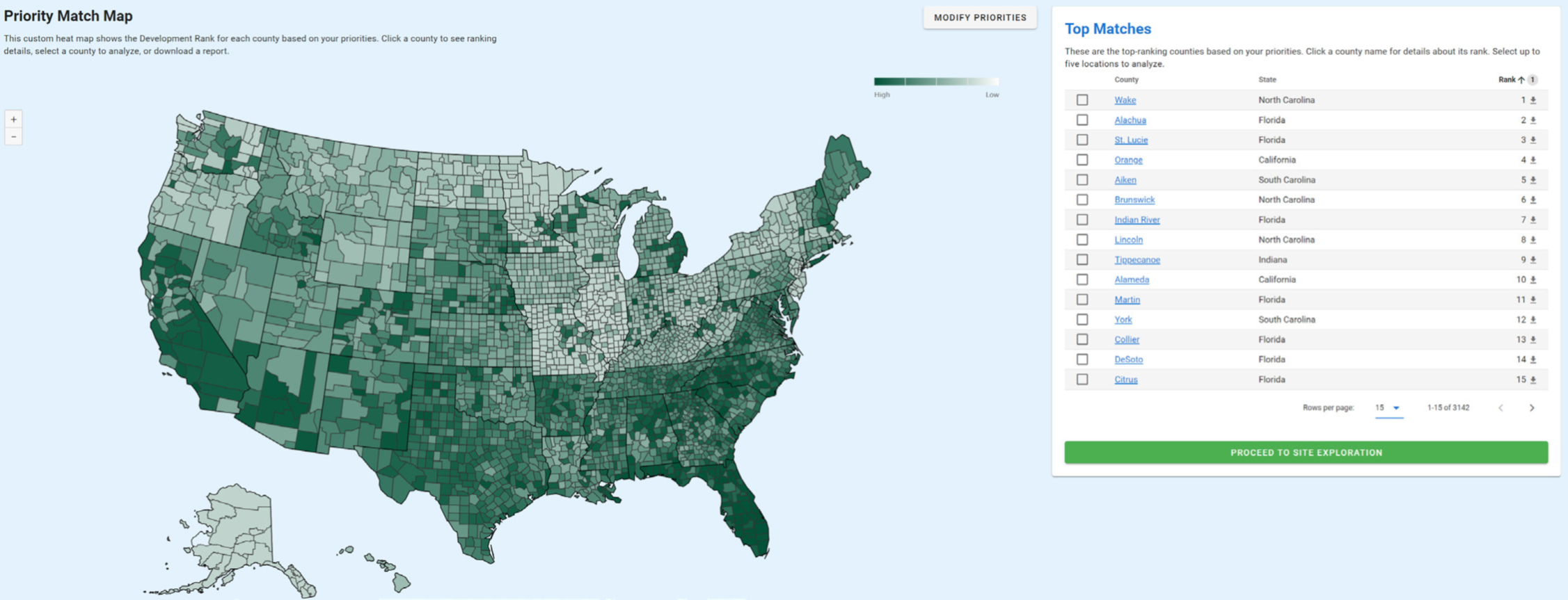
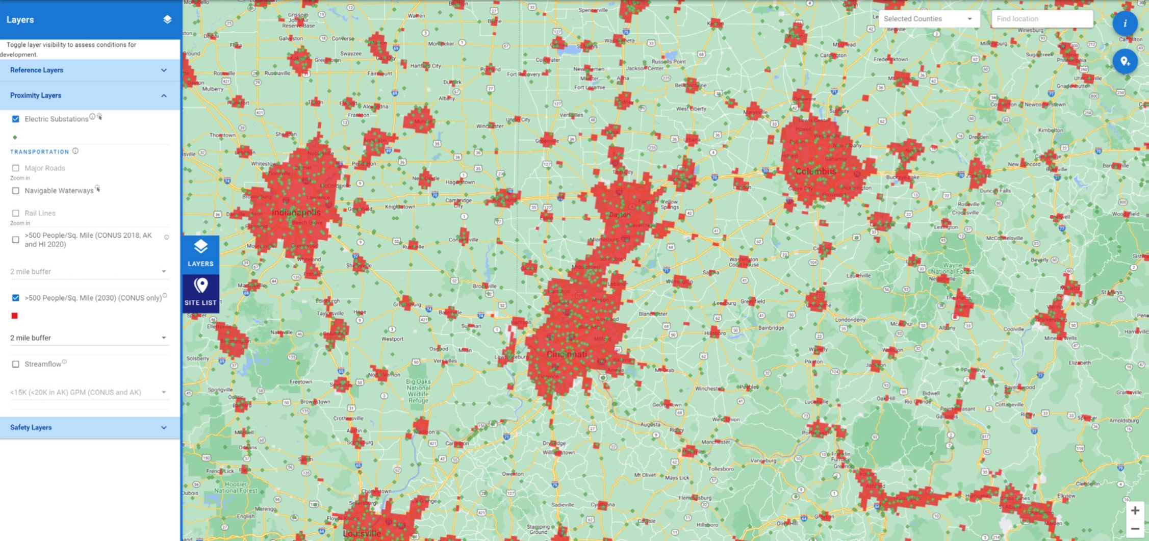
STAND is an integrated tool used to help identify and compare possible nuclear power plant locations in the United States (U.S.). It was developed to aid members of the advanced nuclear technology industry, regulatory agencies and those interested in investing in advanced nuclear technologies to answer the questions of “Where?” and “Why there?” by considering geographical factors related to socioeconomics, proximity and safety.
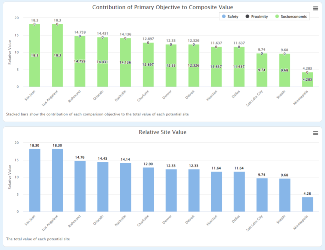
- Socioeconomic – Social, economic and local energy policy factors that could potentially influence state and local acceptance of construction and operation of the facility.
- Proximity – Environmental and regulatory exclusion zone criteria, and distances to infrastructure that could facilitate or support construction and operation of the facility.
- Safety – Regulatory guidelines for environmental and geologic safety factors, safety risks and mitigation approaches.
STAND provides communities and other stakeholders with valuable information for locating potential sites for advanced nuclear technologies. It gives users a holistic view of the locations and helps prioritize public safety.
Click on the link below to request access to the STAND tool. The authorization process may take up to 48 hours.
Once you’ve been granted access, click on the link below to use STAND tool.
There are three main features within STAND: Site Discovery, Site Exploration and Site Comparison. These features build upon each other to create a coordinated approach for initial siting considerations.

The Site Discover feature allows users to set values using a priority questionnaire. Based on the inputs, STAND will provide county level information for the U.S. This information is displayed as a priority match map with a color scale indicating top matches for the user. The information used as the basis for the results in each county may be viewed by selecting the county either on the map or in the Top Matches list.
The Exploration feature allows users to view a web Geographic Information System (GIS) which can be used to explore regulatory and/or infrastructure data and select locations for Site Comparison. This feature allows users to interact with the GIS and add layers to provide information relevant to understanding logistics, existing infrastructure, environmental and geological considerations, and currently established energy intensive facilities. If a site is selected using this tool, it can then be easily integrated into the Comparison feature.
Watch the STAND Webinar
On Wednesday, January 26, 2022, NRIC hosted a Tech Talks webinar featuring the new Siting Tool for Advanced Nuclear Development (STAND). Click the links below for the slides and webinar recording.
STAND Partners
